| Aji Chay | |
| Talkheh-Roud | |
| River | |
| Country | Iran |
|---|---|
| State | East Azerbaijan |
| Tributaries | |
| - left | Vaneq River, Saidabad River, Quri Chay |
| - right | Komur River[1], Sian River |
| Length | 265 km (165 mi) |
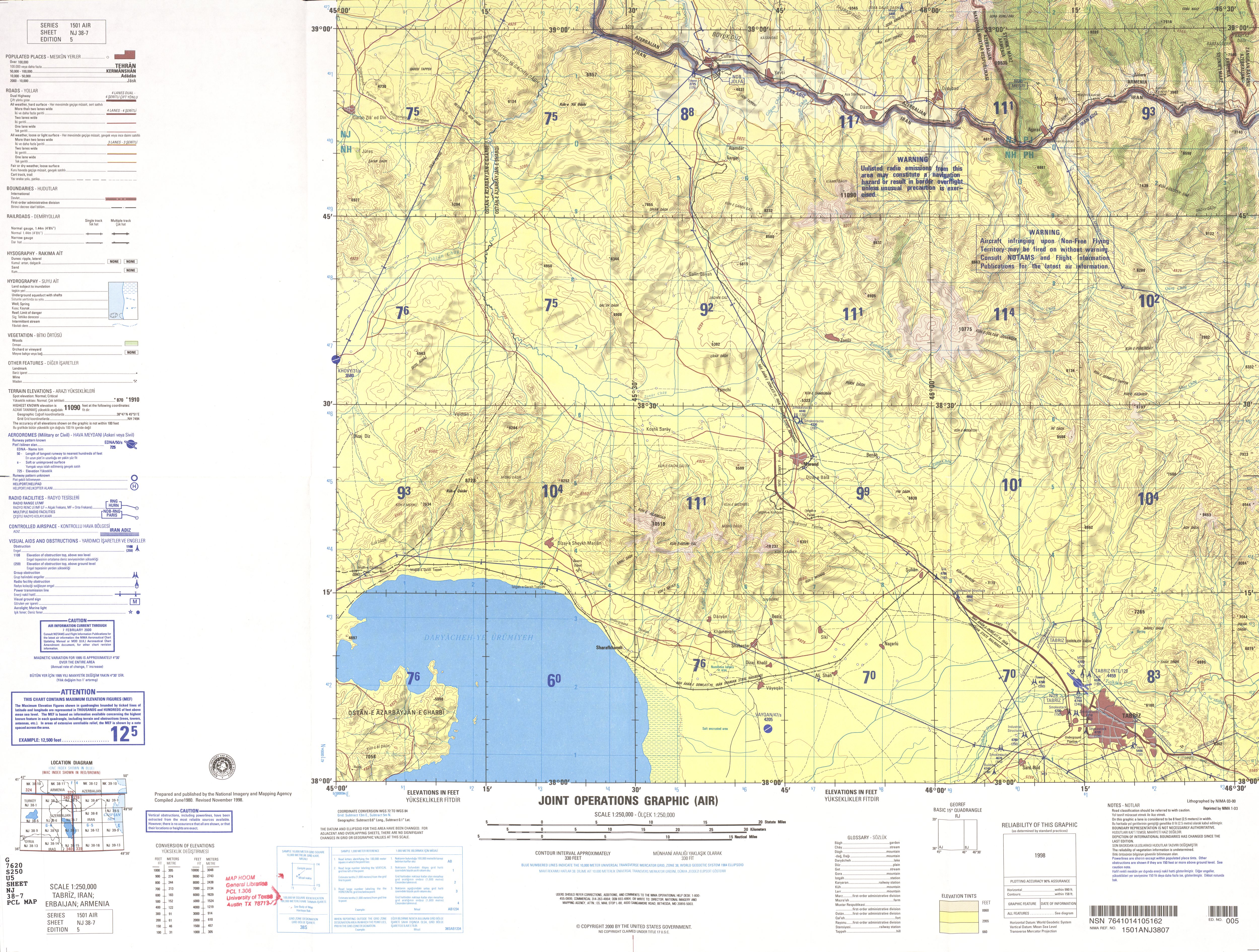
Aji Chay (Azerbaijani: آجی چای, Persian: تلخه رود), or Talkheh-Rūd, is a river in north-western Iran. Most of it is situated in the East Azerbaijan Province.
Its water is alkali due to passing from the lands with high mineralization. It is the largest river that discharges into Lake Urmia. It arises above Sarab from the slopes of Mount Bozgush and Mount Sabalan. Its tributary, the sweet water Quri River (Ghouri or Meydan Chayi), joins the Aji just northeast of central Tabriz.
The Iranian government has a project under development to put the water to agricultural use by altering the watercourse of the Aji Chai away from the alkali lands. As part of this project, the Madani dam is being constructed on the Aji Chai on the northeast side of Eynali mountain, which lies to the northeast of Tabriz.
Historical Aji Chay Bridge over the river, on the old Tabriz road to Marand, is located just outside of Tabriz and east of the Tabriz International Airport.[2]